Friday, November 26, 2010

Rangiroa

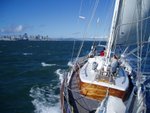
With the thunderstorms and lightnings (very useful, it was like daylight!) the wind increased and we rushed down to Rangiroa, where we arrived too early at the Tiputa Pass (at midnight local time). So we tacked a couple of time, waiting for the sun to show up. We were in the pass at 5am local time, all by the book: sun, tide and wind in the back. We have already overused all our superlatives in the Marquesas, but the Tuamotu seem to deserve some as well... We dropped the anchor in about 40 feet of water, and we still see it... The geography of the atoll is quite different from the Marquesas. We went from 1200 meters for the highest point to about 10... The highest points are the tops of the palm trees.

http://donpedro.lediouris.net/voyage/locator/locator.html?latitude=-14.968666666666667&longitude=-147.63683333333333&scale=14&currentdate=26%20Nov%202010%2C%2008%3A04%20PST%20%28GMT%20-0800%29%3Cbr%3EHDG%3A58%2C%20Speed%3A00.00%20kts%3Cbr%3EWind%3A14.01%20kts%2C%2092%3Cbr%3EWind%3A%20Force%204%2C%20E%3Cbr%3EWater%20Temp%3A28.0%C2%BAC%3Cbr%3ECrystal%20clear%20water%20in%20Tiputa

Avec les orages et les eclairs (tres pratiques, on voyait comme en plein jour) de la nuit derniere, le vent est monté, et on a fait route a toute vitesse sur Rangiroa, et on est arrive trop tot a la passe de Tiputa (a minuit local). On a donc tire des bords devant la passe en attendant que le soleil se montre. On etait dans la passe a 5 heures, comme dans les livres: le soleil, le courant et le vent dans le dos. On a deja usé tous nos superlatifs aux Marquises, mais on dirait que les Tuamotu vont en meriter aussi... On a mouille dans douze metres d'eau, et on voit l'ancre... La geographie de l'atoll tranche un peu avec celle des Marquises. On est passe de 1200 metres de point culminant a environ 10... Les points culminants sont les cimes des palmiers.

----------
radio email processed by SailMail
for information see: http://www.sailmail.com

Sunday, November 21, 2010

On the road, again/Sur la route, encore

We left Nuku-Hiva this morning, heading for the Tuamotu. The conditions are ideal, East wind, between 15 and 20 knots.

http://donpedro.lediouris.net/voyage/locator/locator.html?latitude=-9.367&longitude=-140.47533333333334&scale=7&currentdate=21%20Nov%202010%2C%2017%3A23%20PST%20%28GMT%20-0800%29%3Cbr%3EHDG%3A221%2C%20Speed%3A06.45%20kts%3Cbr%3EWind%3A17.29%20kts%2C%2077%3Cbr%3EWind%3A%20Force%205%2C%20E%C2%BCNE%3Cbr%3EWater%20Temp%3A26.5%C2%BAC%3Cbr%3EOn%20the%20road%2C%20again

On a quitte Nuku-Hiva ce matin, en direction des Tuamotu. Les conditions sont ideales, vent d'est 15-20 noeuds.

----------
radio email processed by SailMail
for information see: http://www.sailmail.com

Monday, November 15, 2010

Anaho Bay/Baie d'Anaho

We has spotted that little bay in the guides, but as it is on the North coast, we were not quite sure is was quite enough at this season... Some people we met yesterday told us it is. And it is indeed, now we are anchored in it, we are the only boat, and this is just beautiful. We have the jaw on the lap!

http://donpedro.lediouris.net/voyage/locator/locator.html?latitude=-8.822333333333333&longitude=-140.06483333333333&scale=14&currentdate=15%20Nov%202010%2C%2018%3A29%20PST%20%28GMT%20-0800%29%3Cbr%3EHDG%3A258%2C%20Speed%3A00.00%20kts%3Cbr%3EWind%3A07.97%20kts%2C%2088%3Cbr%3EWind%3A%20Force%203%2C%20E%3Cbr%3EWater%20Temp%3A28.0%C2%BAC%3Cbr%3EAnaho%20Bay

On avait repere cette petite baie dans les guides, mais comme elle est sur la cote nord, on n'etait pas surs qu'elle soit assez tranquille en cette saison... Des gens qu'on a rencontres hier nous ont dit que si. Et de fait, c'est le cas, maintenant qu'on y est mouilles, on est tout seul, et c'est magnifique. On a la machoire sur les genoux!

----------
radio email processed by SailMail
for information see: http://www.sailmail.com

Sunday, November 14, 2010

Still in Taiohae/Toujours a Taiohae

We wanted to head for Hiva-Oa, but the sea was a real big mess, beyond that actually. Two swells facing each other, and us in between, that was not right.
So after a couple of hours, we eased the sails, and made it back to Taiohae, our base camp.

http://donpedro.lediouris.net/voyage/locator/locator.html?latitude=-8.917166666666667&longitude=-140.1&scale=14&currentdate=14%20Nov%202010%2C%2011%3A50%20PST%20%28GMT%20-0800%29%3Cbr%3EHDG%3A247%2C%20Speed%3A00.00%20kts%3Cbr%3EWind%3A06.63%20kts%2C%201%3Cbr%3EWind%3A%20Force%202%2C%20N%3Cbr%3EWater%20Temp%3A27.0%C2%BAC%3Cbr%3EStill%20in%20Taiohae.

On voulait aller a Hiva-Oa, mais la mer etait un vrai bordel, au-dela de ca meme. Deux houles face a face, et nous entre les deux, ca n'allait pas.
Alors apres quelques heures, on a choque, et nous voila de retour a Taiohae, notre camp de base!

----------
radio email processed by SailMail
for information see: http://www.sailmail.com

Wednesday, November 10, 2010

Baie du Controleur

We left TaioHae for the Baie du Controleur, in the East, and against some swell...
The anchorage seems pretty calm, so far!...

http://donpedro.lediouris.net/voyage/locator/locator.html?latitude=-8.8815&longitude=-140.04616666666666&scale=14&currentdate=10%20Nov%202010%2C%2016%3A25%20PST%20%28GMT%20-0800%29%3Cbr%3EHDG%3A325%2C%20Speed%3A00.00%20kts%3Cbr%3EWind%3A01.78%20kts%2C%20283%3Cbr%3EWind%3A%20Force%201%2C%20W%C2%BCNW%3Cbr%3EWater%20Temp%3A27.5%C2%BAC%3Cbr%3EBaie%20d%27HakaHaa%2C%20au%20fond%20de%20la%20Baie%20du%20Controleur.

Quitté Taio Hae ce matin pour la Baie du Controleur, dans l'est, et contre la houle.
Le mouillage a l'air tres calme, jusqu'a maintenant !...

----------
radio email processed by SailMail
for information see: http://www.sailmail.com

Sunday, November 7, 2010

Back in Taiohae/Retour a Taiohae

We left the shelter of Vaiehu this morning, after a calm night, surrounded with rocks and the thunderclap of the waves hitting the cliffs...
We headed 6 hours against the trade wind, a good steady 5-6, and we are now back in Taiohae, for the supplies, before heading to the south part of the Marquesas.

http://donpedro.lediouris.net/voyage/locator/locator.html?latitude=-8.916333333333334&longitude=-140.0995&scale=14&currentdate=7%20Nov%202010%2C%2015%3A55%20PST%20%28GMT%20-0800%29%3Cbr%3EHDG%3A91%2C%20Speed%3A00.00%20kts%3Cbr%3EWind%3A03.28%20kts%2C%2099%3Cbr%3EWind%3A%20Force%201%2C%20E%C2%BCSE%3Cbr%3EWater%20Temp%3A27.0%C2%BAC%3Cbr%3EBack%20in%20Taiohae

On a quitte l'abri de la baie de Vaiehu, apres une nuit calme, entoure de rochers, et du bruit de tonnerre des vagues contre la falaise...
On a remonte l'alize pendant 6 heures, un bon 5-6, et nous voila de retour a Taiohae, pour le ravitaillement, avant de se diriger vers le sud des Marquises.

----------
radio email processed by SailMail
for information see: http://www.sailmail.com

Saturday, November 6, 2010

Vaiehu Bay

Less than 10 miles away from Hakahau, we're anchored alone in a nice little bay, on the West coast of Ua Pou.

http://donpedro.lediouris.net/voyage/locator/locator.html?latitude=-9.386833333333334&longitude=-140.128&scale=14&currentdate=6%20Nov%202010%2C%2016%3A11%20PDT%20%28GMT%20-0700%29%3Cbr%3EHDG%3A50%2C%20Speed%3A00.00%20kts%3Cbr%3EWind%3A09.30%20kts%2C%2033%3Cbr%3EWind%3A%20Force%203%2C%20NE%C2%BCN%3Cbr%3EWater%20Temp%3A27.0%C2%BAC%3Cbr%3EUa%20Pou%2C%20Vaiehu%20Bay

A moins de 10 milles de Hakahau, on est mouilles dans une jolie petite baie, sur la cote ouest de Ua Pou.

----------
radio email processed by SailMail
for information see: http://www.sailmail.com

Friday, November 5, 2010

Ua Pou

We left Nuku Hiva this morning, and the beautiful little bay we anchored in...
Ua Pou is wrapped into dark clouds. We dropped the anchor at Hakahau Bay.

http://donpedro.lediouris.net/voyage/locator/locator.html?latitude=-9.358833333333333&longitude=-140.04666666666665&scale=14&currentdate=5%20Nov%202010%2C%2016%3A57%20PDT%20%28GMT%20-0700%29%3Cbr%3EHDG%3A45%2C%20Speed%3A00.00%20kts%3Cbr%3EWind%3A10.31%20kts%2C%2035%3Cbr%3EWind%3A%20Force%203%2C%20NE%C2%BCN%3Cbr%3EWater%20Temp%3A27.5%C2%BAC%3Cbr%3EHakaHau%20Bay%2C%20very%20small%20in%20here%21

On a quitte Nukuy Hiva ce matin, et la magnifique petite baie ou on etait ancres...
Ua Pou est enveloppee dans des nuages sombres. On a mouille dans la baie d'Hakahau.

----------
radio email processed by SailMail
for information see: http://www.sailmail.com

Wednesday, November 3, 2010

Taioa Bay/Baie de Taioa

We left this morning the anchorage in Taio Hae Bay, to reach the Taoia Bay, about 5 miles in the west.
That's quite close, but that is bloody remote!
The entrance is pretty narrow, but the bay behind it, wow!, it's like a lake in the middle of the paradise (palm trees, white sandy beach...)!
Another - just one - boat was anchored when we arrived, a Rorqual, I believe.

http://donpedro.lediouris.net/voyage/locator/locator.html?latitude=-8.944166666666666&longitude=-140.16333333333333&scale=14&currentdate=3%20Nov%202010%2C%2015%3A34%20PDT%20%28GMT%20-0700%29%3Cbr%3EHDG%3A279%2C%20Speed%3A00.00%20kts%3Cbr%3EWind%3A13.50%20kts%2C%20214%3Cbr%3EWind%3A%20Force%204%2C%20SW%C2%BCS%3Cbr%3EWater%20Temp%3A27.5%C2%BAC

On a derapé ce matin de Taio Hae pour aller a la Baie de Taioa, 5 milles plus a l'ouest. C'est pas loin, mais c'est isolé, c'est le moins qu'on puisse dire.
L'entree est etroite, mais derriere, ah la vache!, c'est comme un lac au milieu d'un paradis (cocotiers, sable blanc...)!
Un autre - juste un - bateau etait mouille quand on est arrivé, un Rorqual je crois.

----------
radio email processed by SailMail
for information see: http://www.sailmail.com